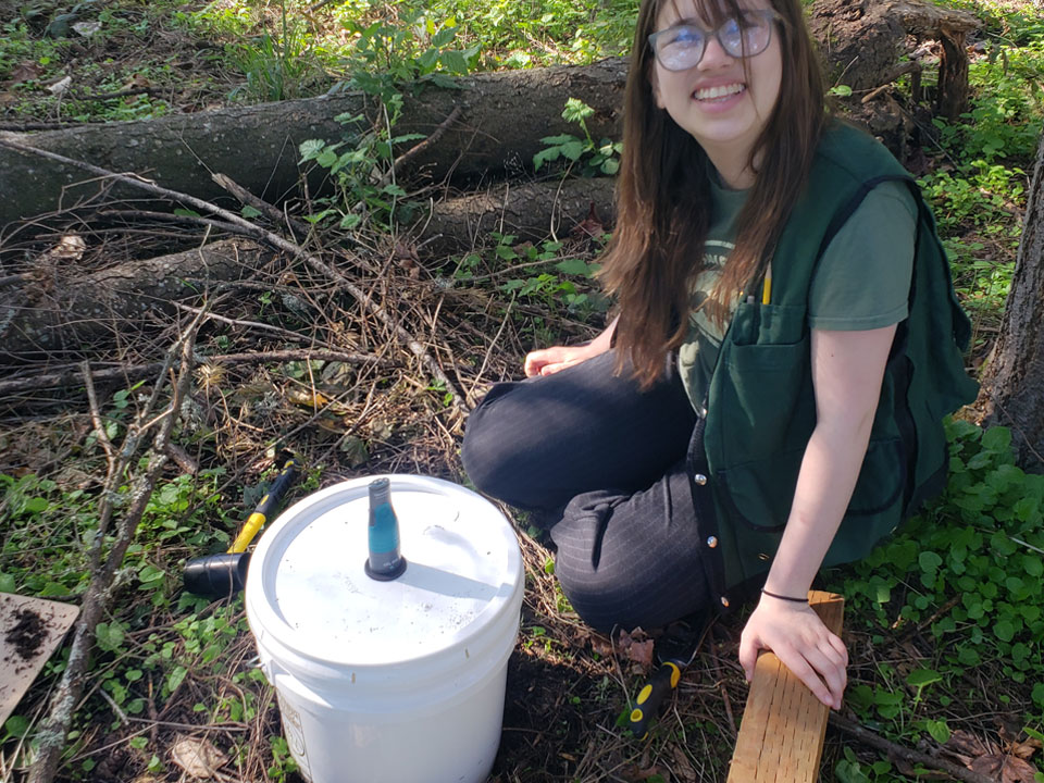
Engaging students in collecting soil respiration data in collaboration with researchers.
Participatory Science is the engagement of the public with current research, scientists, science data collection, and scientific analysis. By conducting Participatory Science activities with their students, they are able to learn real science practices in data collection and contribute to the greater science community. Participatory Science opens communication between learners, volunteer researchers, and paid researchers actively investigating the world around us.
CE – Clean Energy. Bright Futures. is collecting participatory science data in collaboration with EMBER (Embedding Molecular Biology in Ecosystem Research) researchers. The EMBER participatory science activities are available to educators across the country and utilized by EMBER researchers exploring how microbes affect forest health and recovery after drought and wildfire. Additionally, you will be able access data collected by other student groups engaged in participatory science in the future.
How to Participate
Soil microbes are an essential part of ecosystem health and understanding how they thrive and interact with plants is critical to preparing forests and natural spaces for surviving severe weather such as drought or a wildfire event. By collecting soil respiration data your group can help researchers with point in time data to use with the development of new models. To do this your group can collect soil samples to examine later in a classroom or lab, or they can collect soil data in the field.
In the field students can collect data from undisturbed soil samples by utilizing a soil respiration chamber or they can collect soil samples from the top 5 cm or top 10 cm of soil to analyze in a closed container.
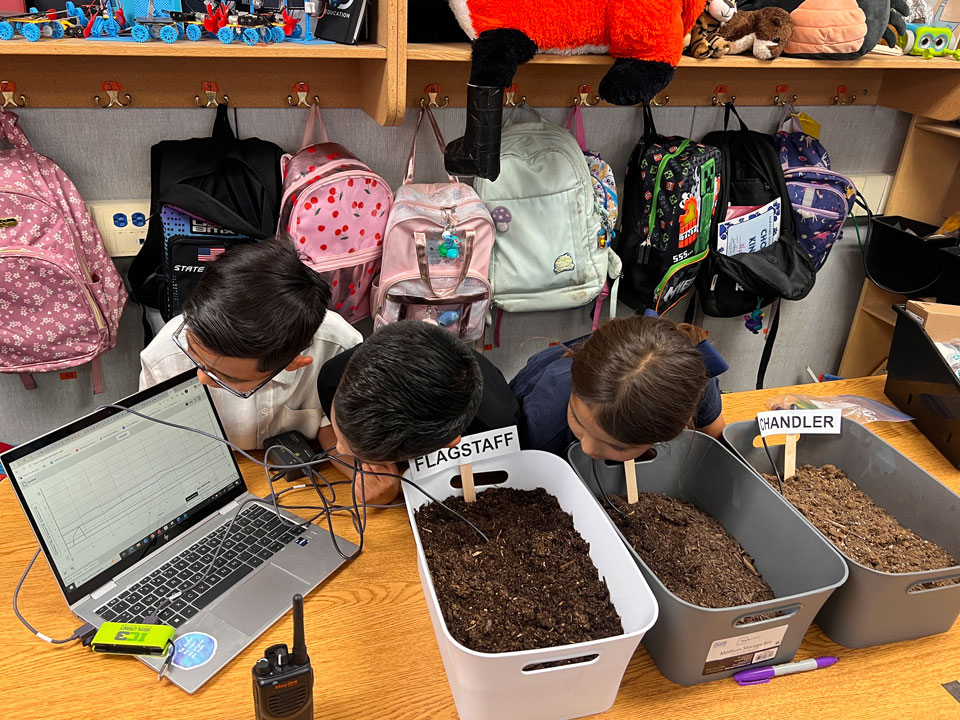
In the lab or classroom students can analyze previously collected soil respiration and run experiments on the soil to gain additional understanding of how soil conditions affect respiration and microbial growth.
See the EMBER Participatory Science Guide for details
Coming in May – Explore units and lessons created by teacher-leaders that incorporate EMBER Participatory Science
Background Content and Resources
The EMBER Project is an interdisciplinary research project with primary investigators from the fields of molecular biology, physiology, ecosystem ecology, and modeling. To provide a meaningful experience for your students you do not need to be an expert in any of these areas of study, however; we have provided the following resources to help provide some background as well as places to learn more.
At the beginning of our collaboration with the EMBER primary investigators we asked each group to provide background information for students to gain understanding of the science, careers, and objectives behind EMBER. These videos provide introductory and more advanced information on soil science, microbes, modeling, and ecology.
In 2025, we facilitated two workshops on teaching climate impacts on forests. These workshops covered current tools and resources for explaining climate impacts and the history of wildfires. These workshops included a brief introduction to using the Vernier Go Direct CO2 sensor and the Vernier Go Direct Soil Moisture Sensor which are the recommended sensors for collecting this participatory science data with your students. Additionally, all of the resources mentioned in the workshops as well as other helpful resources to getting started teaching climate impacts with your students have been collected into our Teaching Climate Impacts on Forests Resource Page.
To better understand how participatory science can fit into your classroom, why the EMBER project is looking so closely at the soil and soil microbial communities, and gain background on how to engage in data collection for EMBER Participatory Science, we hosted a training for members of the 2025-2026 Clean Energy Fellows EMBER Cohort along with EMBER primary investigator Dr. Laurel Lynch.
Vernier Go Direct sensors were selected as our recommended sensors because of their ease of use. We have created resources to help give you a background on how to use the Go Direct CO2 sensor and the Go Direct Soil Moisture sensor. If you are going to use the Vernier tools, you will need the free version of the Vernier Graphical Analysis Software. We have also found Vernier Science Education to be very helpful if you have additional questions about the sensors.
Suggested Materials
Needed Materials
- EMBER Participatory Science Guide
- Camera (with geolocation preferred)
- CO2 gas sensor (recommended example)
- Thermometer/temperature sensor (included in recommended CO2 sensor)
- Soil moisture sensor (recommended example)
- Shovel or hand trowel
- Container for capturing gas readings
Additional Undisturbed Soil Data Materials
- Soil respiration chamber (recommended build)
- Rubber mallet
Additional Disturbed Soil Collection Materials
- 2mm mesh soil sieve (example)
- Ruler with cm measurments
- Basin to collect sieved soil
- Container to hold soil and take CO2 gas readings
- Scale (grams)
- Baking sheets / oven
- (Optional) Water
Submit Your Data
There are two options for submitting your data. For uploading one set of measurements for a given site (or a site with an experiment) Please use the Google Form. This form will let you upload your site photos as well as CO2/Soil Moisture over time datasheets saved as an excel or .csv file.
If you are taking multiple readings from the same site have multiple datasheets for one site, or entering many sites at once, you may prefer to download the EMBER Data Collection Sheet and use the secondary form to upload this information along with your datasheets saved as an excel or .csv file. Please note you can only upload up to 10 site photos and 10 data sheets at a time with the spreadsheet upload form.
Please download and use this spreadsheet for the spreadsheet upload form:
Data Needed for Submission
Site Specific:
- Sample Collection Date
- Time of Sample Collection
- Photo with geolocation (if possible) of the site, photo should include the soil and nearby plants and grasses.
- Coordinates of site if photos do not have geolocation
- Atmospheric temperature at time of collection
- Weather notes
- Landscape use type
- Habitat type
- Names of identified plants at site
- (Optional) Date of last known fire
- (Optional) Intensity of last known fire
- (Optional) Any other relevant site or data collection notes.
Soil Data:
- Soil composition
- Soil collection depth
- Spreadsheet with CO2 in ppm and time (include temperautre and soil moisture at the same time if possible) OR static measurement
- Soil temperature during measurement period
- Soil moisture % during measurement period
- Dry weight of soil in grams (only needed if soil is disturbed for measurement)
- (Optional) Sieved soil spreadsheet with CO2 in ppm and time (include temperature and soil moisture at the same time if possible) OR static measurement
- (Optional) Soil temperature during sieved soil measurement period
- (Optional) Soil moisture % during sieved soil measurement period
- (Optional) spreadsheets of measurements for testing treatment